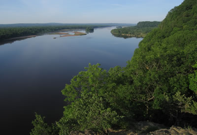
Lower Wisconsin River
Project Description

Like the other large river IBAs, the Lower Wisconsin River is a very dynamic system, representing a nearly continuous, shifting mosaic of important plant-animal communities that serve as critical bird habitat, ranging from forest to open wetland, barrens, savanna and grassland. Most significantly, this IBA is one of southern Wisconsin’s most important forested landscapes and contains critical habitat for many southern forest interior birds, including such high conservation priority species as red-shouldered hawk, cerulean warbler, Kentucky warbler, prothonotary warbler, and wood thrush. Because of the IBA’s significance, the complexity of this mosaic, its divergent management needs, and the demands placed upon it for human uses ranging from recreation to forestry and agriculture, planning is difficult yet critical. Birds represent just one of many components to be considered, yet because their associations with habitat are fairly well understood, they may serve as indicators of habitat quality for other flora and fauna as well.
The conservation planning process for this IBA has unfolded ahead of a renewed master planning process for the LWSR. A master plan is a set of documents that details the resource management, facility development, and public use that will take place on a state property or collection of properties. The Riverway’s present master plan is over 20 years old and WDNR anticipates beginning development of an updated one within the next several years. The conservation strategy nearing completion for the Lower Wisconsin IBA is intended to provide detailed, bird-focused information useful to the various LWSR land managers in their ongoing management of this large, complex, and ecologically significant site, as they bridge the gap between an outdated master plan and the development of a new one. It also should prove a valuable resource in identifying and planning for the long-term needs of priority birds and their habitats once the new master planning process is underway.
The Lower Wisconsin River IBA conservation strategy relies on many sources of information collected in recent decades, including breeding-bird surveys conducted for various WDNR inventories, monitoring programs and research projects, winter bald eagle monitoring by Ferry Bluff Eagle Council and sandhill crane migration counts done by the International Crane Foundation, and anecdotal records submitted to the eBird website. In recent years, several studies and inventories have targeted species, sites and communities of special ecological significance.
As with the Lower Chippewa and Leopold-Pine Island IBA projects, the Lower Wisconsin IBA project is guided by a strategic process that attempts to determine the IBA’s most valuable contribution to bird conservation in local (e.g., Ecological Landscape), statewide, and regional (upper Midwest) contexts. The IBA conservation strategy uses this strategic focus to set priorities for bird species and habitats and proposes recommendations for their management, emphasizing an adaptive approach.
The different managers responsible for the various management activities across the LWSR have been informed about the IBA conservation strategy throughout its development and have participated in reviewing various drafts. The final report is expected to be completed, with their input, in fall of 2010.
Next Steps
- Developing a monitoring strategy: A monitoring program is needed to track critical bird populations and their habitats. An ongoing WDNR study—supported by a State Wildlife Grant and USFWS grant and various statewide monitoring programs—is experimenting with various monitoring techniques to devise such a program by 2013. Included are: breeding bird point-counts in upland and floodplain forests and barrens, along with standard “forest recon” used by foresters to monitor forest conditions but modified here to incorporate variables such as understory structure known to be important to birds; early morning roadside counts modeled after the North American Breeding Bird Survey; nocturnal roadside counts that incorporate the methods of the Wisconsin Frog and Toad, Nightjar and Owl surveys; red-shouldered hawk survey (by canoe, using call playbacks); and Marsh Monitoring surveys (using playbacks).
- Cerulean warbler research: Because this IBA represents one of the best areas for the critically imperiled cerulean warbler in the Midwest, and because forestry is an important, ongoing activity on both public and private lands within the IBA, it is important that we understand the habitat needs of this species and its response to various forestry practices. An ongoing WDNR study—funded by USFWS—is trying to answer these questions by comparing the structure, composition and management history of forest stands that support ceruleans with stands that do not. Data are being gathered simultaneously on other forest birds, so that their relationships with these same forest features can be better understood, and so that we can determine the value of the cerulean warbler as an “umbrella” species that might predict the presence of other important forest interior birds.
- Incorporating results into planning and management: In order for the above activities to help guide conservation efforts in the IBA, results should be incorporated into ongoing management on public and private lands, and planning efforts. This involves continuing work with land managers, foresters, landowners, planning teams, and the public.
Partners
Documents
- A Bird Conservation Strategy for the Lower Wisconsin River Important Bird Area
